TORUS Maps Enters the Market

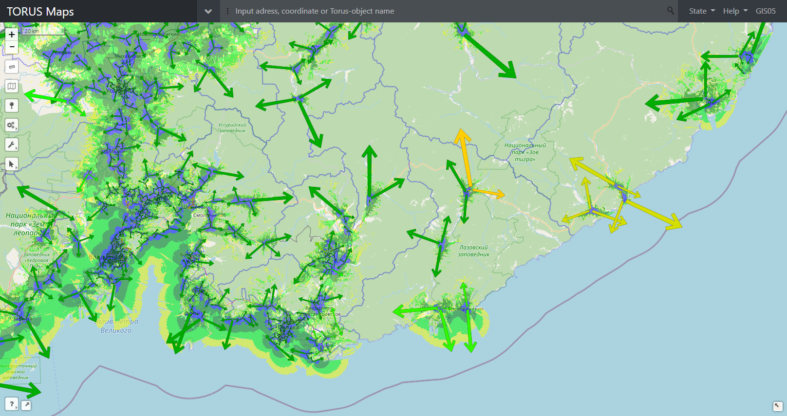
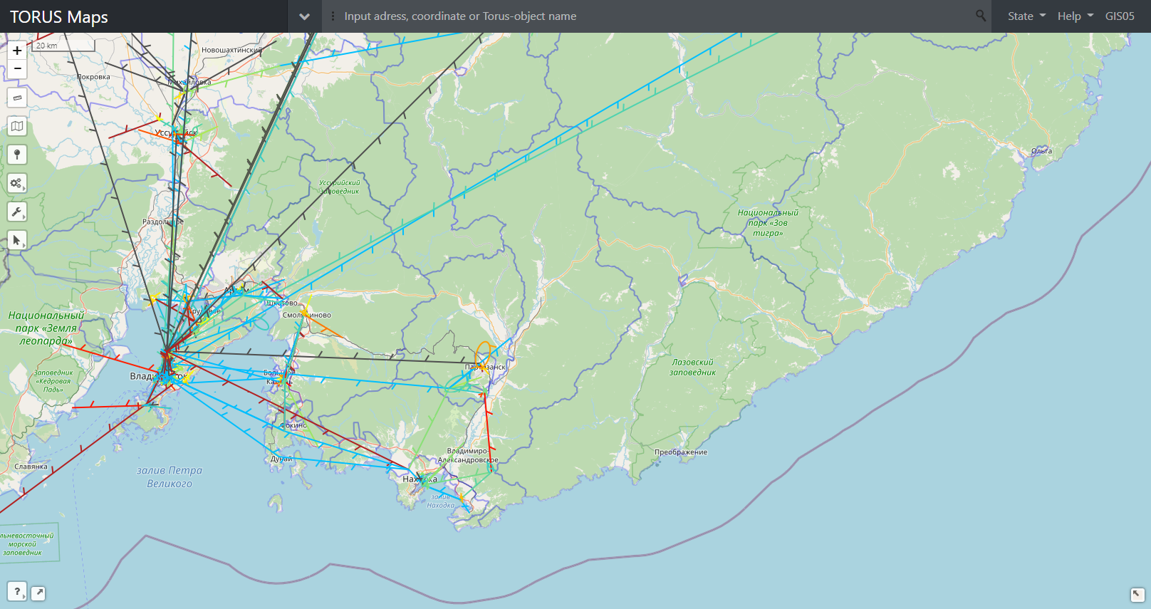
GISware Integro company proudly presents TORUS Maps – a new web-based GIS platform for visual analysis and interactive management of spatial data which comes from various sources and changes in time. TORUS Maps is a versatile web mapping system, ready for high-load and suitable for any business and departments, which deal with geo-objects, their attributes, timelines of online and historic data (e.g. IoT), custom queries to those, optimal routing and traffic distribution, service coverage and data/voice traffic maps, subscribers troubleshooting requests, and many other types of spatial data of a kind.
TORUS Maps is suitable both for huge and small telecom businesses and best benefits to:
-
Telecommunications & IT
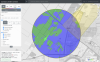
- in respect of network statistics data visual analysis, which comes from variety of network elements,
- in base-station serving zones and QoS coverage maps calculation,
- in subscriber requests processing and aggregation;
-
Oil & gas
- in gas- and oil-fields exploitation monitoring,
- in hardware maintenance control,
- in cadaster management and resources inventory,
- in environmental protection;
-
Transport & logistics
- in optimal routing and navigation, delivery tracking,
- in traffic flows modelling, hubs and logistics centers optimal placement modelling;
-
Construction & civil engineering
- in communications, pipelines, energy and transport networks planning,
- in management of construction sites alternative designs with various options.
TORUS Maps platform is flexible. It can be easily integrated with different customer’s systems, e.g. PM, FM, Inventory, BPM, CRM in respect to telecommunication networks management and company’s IT in general.
TORUS Maps platform have had successfully gone through childhood, adolescence, and youth epochs and now is the firm “grown-up” solution embedded at Tele2 Russia’s network, who is the one of the top 3 leading mobile operators in Russia.
SmartGIS system is tailor-maid for Tele2 Russia. It was developed by GISware Integro company on top of its own TORUS Maps platform. SmartGIS is the web-based GIS solution which automates customer requests handling, improves quality of responses and, in general, lifts the burden off customer support departments of Tele2 Russia telecom operator. This System also facilitates rapid resolution of various technical tasks by O&M and Planning departments. SmartGIS was rolled out at Tele2 Russia at the end of 2020.
Effects of SmartGIS rollout at Tele2 Russia:
- boost both job efficiency and response results quality of Customers’ Support Lines and Technical departments;
- reduce subscribers’ requests processing time, automate processing of mass requests, automate analytic conclusions about network state and troubles “in situ” and, as a result, lift the burden off the customers’ support department staff;
- increase customers’ satisfaction, (e.g. NPS KPI was improved).
Nowadays TORUS Maps platform still undergoes active development. It gains new features for data processing and visualization, including those based on AI and machine learning algorithms. GISware Integro plans to promote TORUS Maps platform at European and CIS telecommunication markets and to apply the Platform in the other industries.
GISware Integro company develops high-performance systems. The Company does business at the telecom OSS/BSS software market for more than 15 years. Our Performance Management systems have been successfully rolled out and now are used by VimpelCom and Tele2, the leading telecom operators in Russia.
![]()
News
13 September, 2022
New version of OSS TORUS supports alternative and opensource RDBMS - PostgreSQL. This now allows to optimize costs for... more
01 November, 2021
November 1st, 2021, GISware Integro releases OSS TORUS system — the fourth generation of software for networks... more
23 July, 2021
GISware Integro company proudly presents TORUS Maps – a new web-based GIS platform for visual analysis and interactive... more
01 February, 2021
A prototype of new Smart Search system was rolled out by GISware Integro company in Tele2 Russia, — being an innovative... more
25 December, 2020
SmartGIS system built on top of our TORUS Maps software platform was successfully integrated by GISware Integro company... more