GIS for Telecoms’ technical departments
TORUS Maps is best suited for technical departments of telecom companies, such as O&M and planning departments:
- High-load platform processes tons of data from PM, FM, Inventory, BPM, CRM and other IT-systems;
- Powerful core instantly transforms, combines and renders all required data onto vivid web-map;
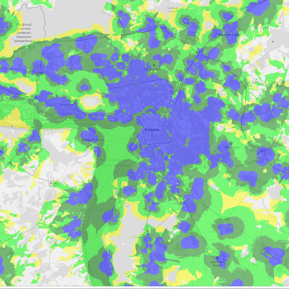
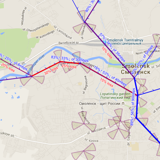
- Unique Geocalculator module creates coverage maps, traffic distribution maps, calculates service degradation maps down to bare details like estimate for suffered subscribers in the problem-zones;
- Advanced UI, packed with modern efficient tools, helps to detect a problem ASAP and to estimate its effect over the quality of the service.
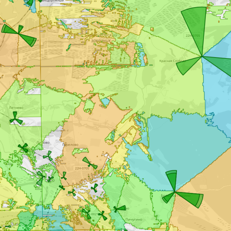
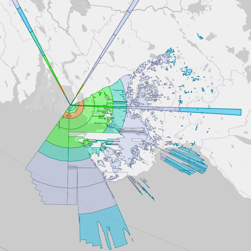
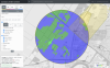
Coverage
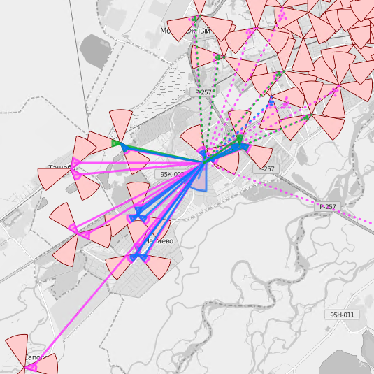
Topology
Service zone boundaries
Handover neighbors
Timing Advance
Unified representation of the network state
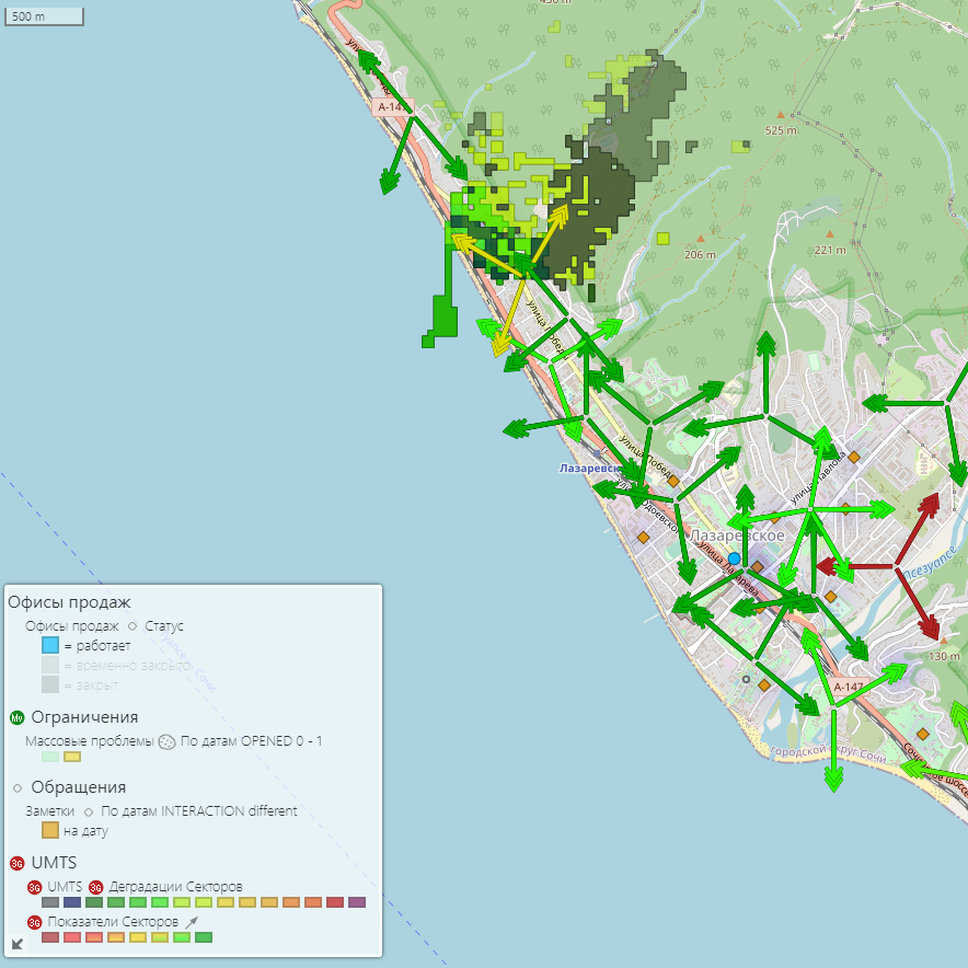
TORUS Maps provides:
-
O&M and planning workflows automation;
-
Control over network utilization level and new capacities rollout progress;
-
Single source for trusted information for all departments.

OPEX decrease
Control over ROI
Revenue growth
News
13 September, 2022
New version of OSS TORUS supports alternative and opensource RDBMS - PostgreSQL. This now allows to optimize costs for... more
01 November, 2021
November 1st, 2021, GISware Integro releases OSS TORUS system — the fourth generation of software for networks... more
23 July, 2021
GISware Integro company proudly presents TORUS Maps – a new web-based GIS platform for visual analysis and interactive... more
01 February, 2021
A prototype of new Smart Search system was rolled out by GISware Integro company in Tele2 Russia, — being an innovative... more
25 December, 2020
SmartGIS system built on top of our TORUS Maps software platform was successfully integrated by GISware Integro company... more